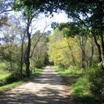
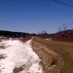
I’ve been intrigued with dirt roads and trails in the ADKs for quite some time. Last weekend I combined a family visit with a two day bikepacking trip. I’ve done the journey in one day, on my rando rig, but this time out I mixed in some dirt roads, as well as traversing the Moose River Plains from Indian Lake to Inlet. My original plan was for ~300 miles from Burlington to the Utica, NY area and it would have mixed in about 100 miles of dirt road, snomo trail, and mountain bike trails. Work and family schedule collided – so I opted for a two day trip, and kept my riding to known dirt routes, to eliminate getting 15 or 20 miles into a trail and having to bushwhack around a beaver pond swamp, or backtrack out.

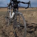
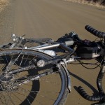
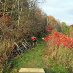
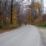
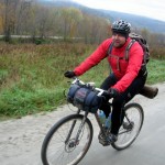
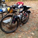
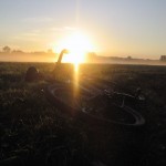
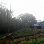
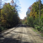
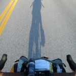
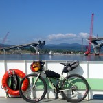
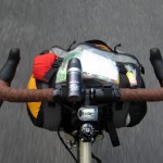
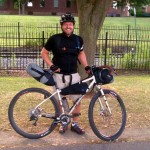
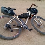
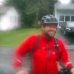
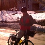
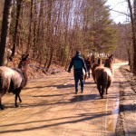
I left Burlington late (for me) after enjoying a coffee and bagel at about 6:30 am. Wil met up with me on his way to work, and snapped a pic. Relatively clean and sweat free in the cool morning, I took off south for the Champlain Bridge and the temporary ferry on some quiet roads following our almost great lake.

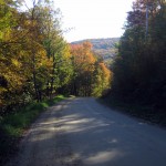
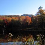
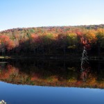
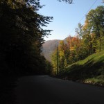
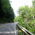
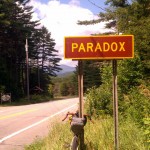
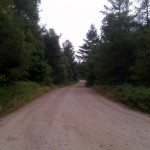
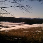
The temps began rising, just as the terrain did. I loosely followed a previous route to Paradox lake, and opted for more pavement than dirt this trip, to expedite my arrival to my overnight destination. I climbed from the lake to Paradox, NY, up and over Factoryville Rd., Creek Rd., and Middle Rd. The helmet came off, and on a very quiet and steep ~8-10% for extended stretches of Middle Rd. I pedaled in the shade on the left side of the road. Completely cooked by the top, I stopped for a bit in the shade and enjoyed some warming water along with a gel. Helmet on, jersey still unzipped, I pedaled on to Rt. 74 and Eagle Lake.

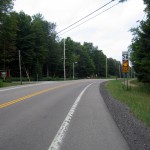
Rt. 74 was busier this time through – either due to my late start or being a Friday morning – so I was careful to take my lane when possible, and move over if I could when a logging truck or RV would come up behind me. I skipped topping off water at the Paradox Lake Campground, and pressed on to my lunch stop in Schroon Lake. A turkey sandwich and chips hit the spot, washed down with a ginger ale. I grabbed some salty snacks to go, and anticipating a hot, tough climb ahead, I topped off my bottle with water and an electrolyte tab, and my bladder with ice and water. About a mile down the road I noticed a drip drip down my back – and stopped to investigate. My bladder was leaking near the cap – so if I squished it in my bag it would leach out, and then down my back, until about 2/3s full. Momentarily it felt good running down my back – but I eventually felt it work its way into my shorts – which would prove troublesome further up the road. While I was stopped I decided to be preemptive about the heat climbing Hoffman Mountain Rd. to Olmstedville and North Creek. I defiled one of the Rapha arm warmers I brought along – I filled it with ice and tied the ends into knots. Ideally a leg from woman’s stocking (available in convenience stores) works for this – but my lunch stop carried neither socks or stockings. Tucking the ice warmer into my jersey collar, I proceeded to slowly climb – even the shaded portions of the road were hot, having soaked in the sun all morning. After what felt like forever grinding away ~10-12%, I reached the rolling top, and looked for my turn to Olmstedville. Troutbrook Rd. was my turn, and once it pointed down it was good fun to carry some speed into town. A quick correction for a navigational error, and I was back on track heading down NY 28N towards North Creek.

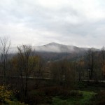
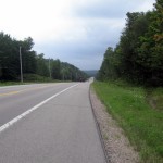
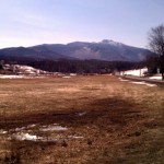
As I approached North Creek I had a few fleeting glimpses of Gore Mt, crossed the Hudson River, and within what felt like minutes I was refreshing my ice and water at a local pizza place. The temps were still high, somewhere in the 80s, and I could see the sunburn on my arms and through the holes in my cycling gloves. I managed to get a cell phone call out here to family, then packed up and quickly made my way to NY 28, north to Indian Lake, 16 miles away. On a previous trip I had a demoralizing climb, and this trip would prove no different. The first 5 miles out of town follow the Hudson with a wide shoulder on a 2 lane state highway. Easy pedaling up the mild river grade, I made good time until I noticed my water bottle was loose. A quick stop to tighten it up put me in front of a wall. By the numbers the hardest part of this stretch is 4 miles with 800 feet of elevation gain – packed into sections ranging from ~6-10% gradient. On a nice 2 lane road, this would be work, but on NY 28, a dedicated ‘bike route’ – it is a wholly different experience. As the climb starts the road changes from 2 lane to 3 lane, with the additional lane being a climbing lane, heading up. Fair enough for vehicles, but whats left of the shoulder is 3 feet tucked between the white line of the climbing lane and the typical highway guardrail. For what felt like every bit of that 4 miles.

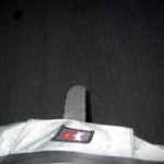
Traffic was insane, and after being buzzed by folks passing on the right, in the truck lane, shooting by me to take on the next car up the road, and the Nth truck or camper blowing me around – I’d had enough. When traffic lulled I crossed the road to enjoy an 6-8′ wide shoulder, and pedaled uphill with my front light blinking, on the wrong side of the road. A few drivers scowled at me coming down – but I had a clear view of oncoming traffic, plenty of time to react, and far less stress moving forward. Somewhere along this climb I noticed the distinct pain coming from my bottom – saddle sore, or something not fitting well. I pressed on, with the pain being a minor annoyance.
Near the top the road reverts back to a typical 2 lane rural highway. Still busy, but with generous shoulders on both sides. I crossed back over, had a snack, and pressed over the remaining uphill rollers to Indian Lake. I was a bit behind schedule, but still comfortable rolling into Indian Lake @ 5:48 PM, 105 miles in my legs, with another 20-30 to go, depending on where I decided to camp.
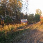
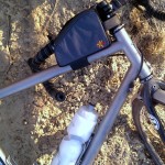
The Stewarts Shop was my resupply. I picked up a heat lamp cheese burger for dinner (surprisingly edible), and for the road snagged some Advil, pop tarts (breakfast), pretzels, cookies for camp, spare batteries as I’d be using both the headlamp and the headlight, ice, and 1 gallon of water, and a liter bottle. Not wanting to purify water (although I did bring along Aqua Mira drops for an emergency) – and to test how ‘cameling up’ a heavy pack with 100+ miles in my legs would feel, I filled my MSR dromedary bag with ice and water, then my hydration bladder and water bottle. I tucked the spare liter bottle into my pack and started to roll out. Immediately after standing up I felt cool water down my back, and left drip marks on the picnic table and parking lot. Feeling alot of water running down my leg I pulled my kit apart only to find dromedary bag also leaking at the cap (this was tested at home, but not under pressure of being squeezed into a pack). I decided to live with it, drank off about 1/3 of my bladder’s water, and carried on, hoping to find a campsite in the fading light of day.

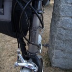
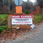
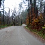
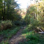
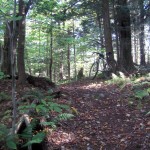
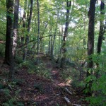
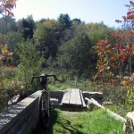
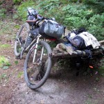
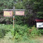
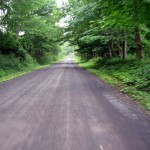
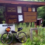
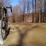
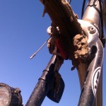
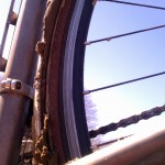
A few miles out of town, about 110 miles from home, I finally turned onto a new road for me – Cedar River Rd. The first few miles are paved, and then finally, my wheels touched the dirt I had sought. Venturing up and over steep rollers, all the while adding elevation while losing daylight, I began working my way to Wakely Dam and the sign in for the Moose River Plains Wild Forest. Somewhere before I signed in (while fighting off the deer flies attacking my hands) I noticed my left crank had a gap to the frame. I stopped, coated up in bug spray, and hoped I’d be able to diagnose and fix any potential problem(s). Thankfully only the crank arm bolts had come loose, so I re-tensioned the bearing adjustment, and tightened them up. Shifting immediately improved – although it wasn’t solved. Throughout the day front and rear shifting was hit and miss – I was nearly ‘friction’ shifting with the SRAM levers – listening for the chain to engage rather than blindly allowing the lever to click. In the daze as I rolled closer to camp I began making up new names for the marketing guys – ‘SRAM Double Tap – because you have to shift twice’, ‘SRAM Double Crap’, etc.
When I mounted back up the horse flies immediately attacked my hands again – in the cutouts from my knit gloves. I eventually pulled the gloves off – and they ceased. Odd, but thinking about it later – perhaps they thought my hands were the eyes on a strange beast of burden laboring through the woods?
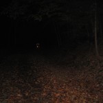
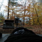
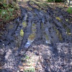
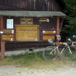
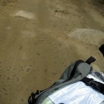
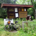
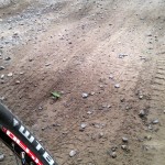
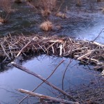
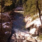
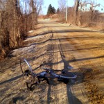
At ~8pm I finally reached the sign in booth, scribbled in the book, had a snack, said hi to a few motorists heading to campsites, and started into the darkening woods. I had no idea how far in I’d have to go to find a suitable campsite – and it felt like it took forever to cover the ground – battling loose sand and pulverized stone, gravel, and dirt with head sized rocks sticking into the road. 2 cars passed me on the way in, and all was quiet. I passed a few abandoned campsites, and eventually got off the bike at ~9pm at a clearing with fire pit next to a creek. I think I had about ~132 miles in my legs. Checking my map I would learn the creek fed directly into the South Branch of the Moose River, not far from my site.

I tried to make quick work of setting up camp – but it was total amateur hour in my tired state. I immediately hydrated and had a snack, then pulled out my ground cloth and the tarp from my Hennessy Hammock. Once the groundsheet was down I ejected gear and changed into some dry camp clothes. After some fussing I had the tarp rigged, although I would end up tweaking it later in the night. It was comical how poorly the tarp would work on its own, not in tandem with my hammock. Had it poured I would have been miserable – but luckily the thunderstorms in the forecast never appeared, and I had stars and the moon to look at between the trees. I was pretty beat, and just wanted to lie down – but I decided to bear bag my cook kit and remaining food. I found a suitable tree by the road and proceeded to unfurl my line, which immediately turned into knotted spaghetti. Under a headlamp, a tired cyclist, in the dark, unknotting, end for end, a 50’+ length of rope… madness.
By the time I finally settled down it must have been close to ~11pm, and I was feeling defeated. My stomach was off, I knew I needed to keep hydrating, and I couldn’t get comfortable. I was amazed at how long it took my body to cool off. I’d been off the bike for ~2 hours – but upon laying down my legs felt like they were on fire. I removed socks and my knickers to no avail. If I pulled my bag over I roasted, so I lay on top of my bag, listening to the creek, and peaking at the stars.
I dozed off at one point, and was awakened by shouting and the grinding of gears. I woke with a start, looked over to the road, and saw headlights approaching. Thankfully they stayed on the road, and the gents shouting over the engine and the noise of the gear box appeared to be trying to get an ill shifting 4×4 out of the woods in the dark. It sounded like construction equipment – and I doubt they had much transmission left upon reaching civilization. Since I was awake I had a nature break, hydrated, and took some Advil. I finally started to feel cool, so I tucked into my bag and drifted off to sleep.
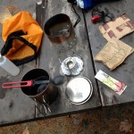
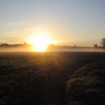
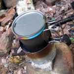
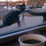
I awoke late (for me) at 6:45am. I started up my stove (carried all this way for a single, delicious cup of coffee) and began repacking my gear. I made some changes to packing order, and simplified what I carried for access on the bike, and what was tucked away. After a slow start I was moving again, and immediately felt some serious pain on my bottom… I pressed on, with the goal of breakfast in Inlet or Old Forge.


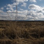
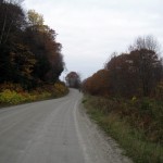
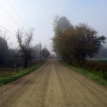
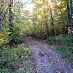
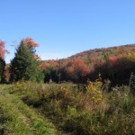
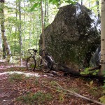
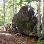
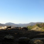
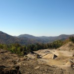
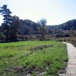
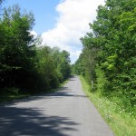
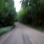
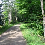
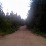
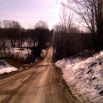
The MRP through this middle section, and in daylight, was a treat. Mixed surface from sandy to compacted dirt and stone, and anywhere from 2 cars wide to just able to fit one. I passed quite a few folks car camping – some in tents, some with pop up tow behind trailers. I wanted to venture off nearly every side road and trail I passed.


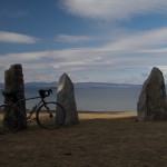
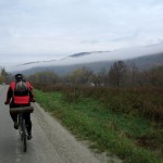
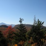
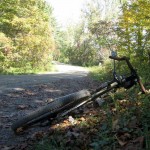
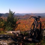
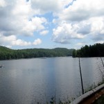
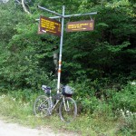
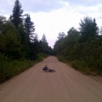
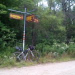
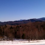
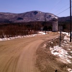
Eventually I made it to a familiar location – the intersection I rode to last winter with the Pugsley. I was now 4 miles from the gate, and maybe 8-10 miles from breakfast. I snapped a matching picture, and moved on, climbing rollers to the Lime Kiln Lake entrance.

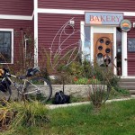
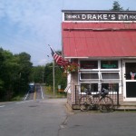
When I hit pavement I found some folks outside of the local fire station and they happily pointed me down the road to Drakes for a great diner style breakfast. I put my phone on the charger, drank a few glasses of OJ, and destroyed my breakfast. I took a bagel to go, and began motoring on to Old Forge.

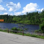
The ~12 or so miles to Old Forge was rough. My saddle to bottom interface was wrong, and I felt pain on nearly every pedal stroke. At one point the act of just getting off the saddle caused pain, so I knew I was in trouble. The heat was climbing again, and I still felt dehydrated. Tiring of traffic on NY 28 I took to the snomo / mtb trails to the side of the road which followed an old railbed. While carfree and quiet, it dropped me 4 miles out of my way and down a fairly good climb. Demoralized I pressed on slowly, and arrived into the thick of Old Forge Saturday morning traffic. The last ~12(+4!) miles took well over 2 hours, and I was doubting I’d make it to dinner with the family. A gas station frozen drink, second breakfast, and topping up my water had me feeling better. I loaded up some snacks for the road, and pressed on, with another ice warmer tucked into my jersey around my neck. Traffic came and went in bunches it seemed, and the road was pleasant enough. I eventually crossed the Moose River near McKeever, miles downstream from my campsite the night before.

At McKeever my original plan was to take a forest road to Woodhull Lake, and then follow snomo / mtb trails to the Sand Lake Lean To, from where I would connect various trails in the Black River Wild Forest to pop out at Haskell Rd. on Rt. 8, well south and east of my actual route. Due to some limited information on trail conditions, and not feeling like adding ~60 miles (30 of trail) to my trip, I pressed on the pave to Woodgate, where I turned off NY 28 for quiet roads towards the Hinckley Reservoir and Poland, NY. The temps dropped, and I was misted with rain between Woodhull and the reservoir – and my speed and mood picked up. At some point a blister on my bottom popped, and I felt some relief when in the saddle – but for most of the day I was riding tipped to one side, and compromised of my power and ability to move around on the bike. Stretches of road I expected to ride at 14-16 mph were agonizing at 10-12.
Nearing Poland and West Canada Creek the sky opened up and I was in a deluge. I worked my way to a storefront to don my rain jacket and work out the final few miles to where I was meeting family for dinner. I was likely to be only 1/2 hour late, and a phone call confirmed that hot food would be waiting for me on the grill. I pulled up GoogleMaps on my phone and attempted to work out an easy way into town. Under cover I was able to convince the screen that my wet fingers were really trying to type, but roadside, to check an unnamed intersection, the rain drops and the touchscreen had a mind of their own. I managed to find some very nice, quiet, narrow roads into town, at the price of climbing every steep stretch of pavement up and over each bit of terrain, while trying to lose elevation into the valley below. My navigating in the rain with a touch screen bought me some bonus miles – but I felt strong, and probably had the fastest run (even climbing) since early in my first day. Eventually I hit the last long descent into town – and topped out at 46 mph fully loaded, with no adverse shimmy, shake, or disturbance, save the wind driven rain pelting me in the face. A few turns later, and I was under an awning at the in-laws with a burger on the grill, and a smile on my face.

~238 miles, ~13k climbing
~50 miles dirt road and trail
Lots to write about what I learned about gear, my body, and my mind. I’ve been off the bike since letting my bottom heal – the worst damage I’ve done, including some painful early brevets. I can say that a Brooks saddle is in the works for the Fargo… and I’m hoping to get out this weekend.